Elementary Surveying: An Introduction to Geomatics, 15th Edition Solution Manual

Elementary Surveying: An Introduction to Geomatics, 15th Edition Solution Manual is your guide to textbook mastery, offering detailed solutions to every chapter's exercises.

Nora Walker
Contributor
4.6
58
6 months ago
Preview (16 of 270 Pages)
100%
Purchase to unlock

Page 1

Elementary Surveying: An Introduction to Geomatics, 15th Edition Solution Manual - Page 1 preview image

Loading page ...

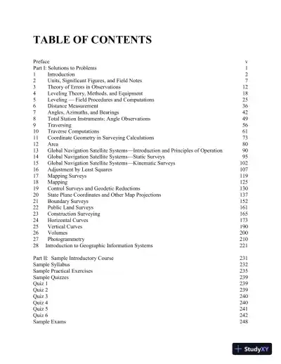
TABLE OF CONTENTSPrefacevPart I:Solutions to Problems11Introduction22Units, Significant Figures, and Field Notes73Theory of Errors in Observations124Leveling Theory, Methods, and Equipment185Leveling — Field Procedures and Computations256Distance Measurement367Angles, Azimuths, and Bearings428Total Station Instruments; Angle Observations499Traversing5610Traverse Computations6111Coordinate Geometry in Surveying Calculations7312Area8013Global Navigation Satellite Systems—Introduction and Principles of Operation9014Global Navigation Satellite Systems—Static Surveys9515Global Navigation Satellite Systems—Kinematic Surveys10216Adjustment by Least Squares10717Mapping Surveys11918Mapping12519Control Surveys and Geodetic Reductions13020State Plane Coordinates and Other Map Projections13721Boundary Surveys15222Public Land Surveys16123Construction Surveying16524Horizontal Curves17325Vertical Curves19026Volumes20027Photogrammetry21028Introduction to Geographic Information Systems221Part II:Sample Introductory Course231Sample Syllabus232Sample Practical Exercises235Sample Quizzes239Quiz 1239Quiz 2239Quiz 3240Quiz 4240Quiz 5241Quiz 6242Sample Exams248

Page 2

Page 3

Page 4

Page 5

Page 6

Page 7

Page 8

Page 9

Page 10

Page 11

Page 12

Page 13

Page 14

Page 15

Page 16

Preview Mode

This document has 270 pages. Sign in to access the full document!

Study Now!

XY-Copilot AI
Unlimited Access
Secure Payment
Instant Access
24/7 Support
Document Chat

Related Documents

View all