Solution Manual for Historical Geology: Interpretations and Applications, 6th Edition
Solve textbook problems faster with Solution Manual for Historical Geology: Interpretations and Applications, 6th Edition, a must-have for every student.
Chloe Martinez
Contributor
4.5
152
7 months ago
Preview (25 of 83)
Sign in to access the full document!
1
1
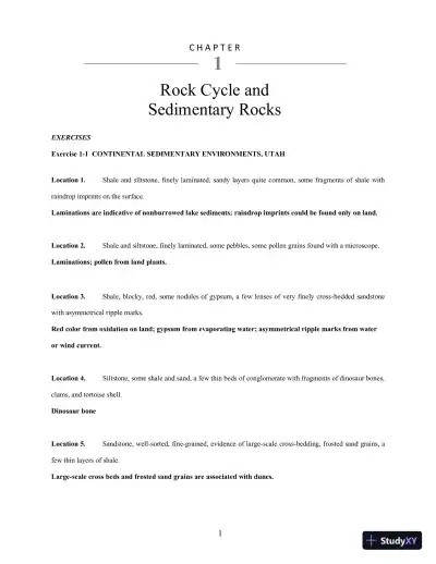
EXERCISES
Exercise 1-1 CONTINENTAL SEDIMENTARY ENVIRONMENTS, UTAH
Location 1. Shale and siltstone, finely laminated, sandy layers quite common, some fragments of shale with
raindrop imprints on the surface.
Laminations are indicative of nonburrowed lake sediments; raindrop imprints could be found only on land.
Location 2. Shale and siltstone, finely laminated, some pebbles, some pollen grains found with a microscope.
Laminations; pollen from land plants.
Location 3. Shale, blocky, red, some nodules of gypsum, a few lenses of very finely cross-bedded sandstone
with asymmetrical ripple marks.
Red color from oxidation on land; gypsum from evaporating water; asymmetrical ripple marks from water
or wind current.
Location 4. Siltstone, some shale and sand, a few thin beds of conglomerate with fragments of dinosaur bones,
clams, and tortoise shell.
Dinosaur bone
Location 5. Sandstone, well-sorted, fine-grained, evidence of large-scale cross-bedding, frosted sand grains, a
few thin layers of shale.
Large-scale cross beds and frosted sand grains are associated with dunes.
C H A P T E R
Rock Cycle and
Sedimentary Rocks
1
1
EXERCISES
Exercise 1-1 CONTINENTAL SEDIMENTARY ENVIRONMENTS, UTAH
Location 1. Shale and siltstone, finely laminated, sandy layers quite common, some fragments of shale with
raindrop imprints on the surface.
Laminations are indicative of nonburrowed lake sediments; raindrop imprints could be found only on land.
Location 2. Shale and siltstone, finely laminated, some pebbles, some pollen grains found with a microscope.
Laminations; pollen from land plants.
Location 3. Shale, blocky, red, some nodules of gypsum, a few lenses of very finely cross-bedded sandstone
with asymmetrical ripple marks.
Red color from oxidation on land; gypsum from evaporating water; asymmetrical ripple marks from water
or wind current.
Location 4. Siltstone, some shale and sand, a few thin beds of conglomerate with fragments of dinosaur bones,
clams, and tortoise shell.
Dinosaur bone
Location 5. Sandstone, well-sorted, fine-grained, evidence of large-scale cross-bedding, frosted sand grains, a
few thin layers of shale.
Large-scale cross beds and frosted sand grains are associated with dunes.
C H A P T E R
Rock Cycle and
Sedimentary Rocks
1
EXERCISES
Exercise 1-1 CONTINENTAL SEDIMENTARY ENVIRONMENTS, UTAH
Location 1. Shale and siltstone, finely laminated, sandy layers quite common, some fragments of shale with
raindrop imprints on the surface.
Laminations are indicative of nonburrowed lake sediments; raindrop imprints could be found only on land.
Location 2. Shale and siltstone, finely laminated, some pebbles, some pollen grains found with a microscope.
Laminations; pollen from land plants.
Location 3. Shale, blocky, red, some nodules of gypsum, a few lenses of very finely cross-bedded sandstone
with asymmetrical ripple marks.
Red color from oxidation on land; gypsum from evaporating water; asymmetrical ripple marks from water
or wind current.
Location 4. Siltstone, some shale and sand, a few thin beds of conglomerate with fragments of dinosaur bones,
clams, and tortoise shell.
Dinosaur bone
Location 5. Sandstone, well-sorted, fine-grained, evidence of large-scale cross-bedding, frosted sand grains, a
few thin layers of shale.
Large-scale cross beds and frosted sand grains are associated with dunes.
C H A P T E R
Rock Cycle and
Sedimentary Rocks
Chapter 1
2
Location 6. Claystone, dark gray, platy, a few fragments of large leaves.
Leaf fragments from land plants
Location 7. Sandstone, well-sorted, fine-grained, a few pieces of petrified wood present.
Petrified wood from land plants permineralized by groundwater
Location 8. Siltstone and shale, gray, a few snails, bivalves, and ammonite fragments.
Ammonites (Figs. 4.25, 4.26) were marine creatures; probably not a continental deposit.
Location 9. Coarse sandstone, well-defined cross bedding, crocodile bone fragments.
Crocodile bones fragments could be freshwater, estuarine or nearshore marine.
Exercise 1-2 PALEOGEOGRAPHIC MAP
Figure 1.24 Paleogeographic map of sedimentary environments
Chapter 1
3
Exercise 1-3 PALEOGEOGRAPHIC MAP OF CHINLE FORMATION, UTAH
NORTH
Figure 1.25 Location map for Chinle Formation Database
Questions
1. Describe the depositional nature of the Chinle sandstone as developed by the isopach map.
Main channel runs from west to southeast with a subsidiary channel coming from the northeast. The
sand thickens in the channel from the confluence of the two streams southward.
2. What kind of surface exists between the Chinle and Moenkopi formations? Cite evidence for your
conclusion.
There is a significant change in depositional environment at the unconformity. Also there is erosional
Chapter 1
4
down cutting into the uppermost “horizontal” Moenkopi units.
3. Draw an arrow on your map showing the direction of the stream flow as derived from the contouring.
(Arrow should go from west to southeast; see Fig. 1.25.)
Exercise 1-4 CARLSBAD CAVERNS, NEW MEXICO
Questions
a. On the location map, Fig. 1.28, construct a lithofacies map of this region. Label the fore reef, reef, and
back-reef areas.
(See the Permian Reef cross-section, Fig. 1.27.)
b. In which direction was the shoreline (land) during this interval of the Permian?
Shoreline was northeast, toward the back reef area.
c. Contrast the water conditions that probably existed in the northwest corner of the map area with those in
the southeastern corner.
Northwest: Back reef, restricted circulation, evaporites
Southeast: Reef talus, deep marine shale
d. Where would you make your speculative land purchase? (Show the location on the lithofacies map.)
What were your reasons for choosing this area?
Purchase would be northeast of the cavern opening. High porosity would indicate the possibility
of caverns.
Chapter 1
5
Figure 1.28 Location of sample data
Exercise 1-5 ENVIRONMENTAL ANALYSIS, MISSISSIPPI RIVER DELTA
Figure 1.30 Sample location map
5
Figure 1.28 Location of sample data
Exercise 1-5 ENVIRONMENTAL ANALYSIS, MISSISSIPPI RIVER DELTA
Figure 1.30 Sample location map
Loading page 6...
Chapter 1
6
Questions
1. Using Fig. 1.30 as a base map, draw a sediment distribution map showing clean sand, silty sand, muddy sand,
and mud. (See Fig. 3.7, Construction of Lithofacies Maps.)
2. Outline with a red pencil the approximate boundary of the potential oyster bed. Describe its bottom
sediments.
Clean, well-sorted, fine-grained sand
3. Starfish are a natural predator of oysters. Suggest how a starfish could kill and eat such a bivalve.
Starfish will cover both valves and apply enough outward pressure on the oyster until it barely opens.
Once slightly opened, the starfish begins to “eat” the soft parts of the oyster or clam.
4. What gives the muddy samples the dark gray to black coloration?
Finely disseminated organic material
5. Why is sand concentrated at the mouth of Pass a Loutre, Southeast Pass, and South Pass?
Mixtures of sand and mud move down the distributaries, but wave and current energy winnow the fine
particles from the sand.
6. Why is the sand concentrated on the southern side of the passes? (Note the spit development at South Pass, area
B on the U.S. Geological Survey map, Fig. 1.29.)
Sand is carried south by the prevailing long-shore current.
7. Pass a Loutre is one of the principal distributaries on the Mississippi Delta. How does such a distributary network
differ from a normal dendritic stream drainage pattern?
The distributaries deposit sediment supplied by the main stream. Normal stream tributaries collect water
and sediment and carry it into the main stream.
Loading page 7...
Chapter 1
7
Exercise 1-6 MODERN COASTAL SEDIMENTS, NORTH CAROLINA
EXERCISES
1. Construct maps showing the distribution of each of the sediment components. See Table 6.
a. Draw a lithofacies map showing the distribution of sand. (Use a piece of tracing paper to overlay the
location map, then transfer the values from the preceding table onto the tracing paper.) Contour the
data using a contour interval of 10 percent.
b. Draw a lithofacies map showing the distribution of silt. Use a contour interval of 5 percent.
c. Draw a lithofacies map showing the distribution of clay. Use a contour interval of 5 percent.
See Fig. 1.31 a, b, and c
2. Compile a general lithofacies map showing the distribution of the sand-silt-clay sediment fractions, using
boundaries defined by the following percentages:
a. Sand: greater than 60 percent sand = color in yellow.
b. Silt: greater than 15 percent silt = color in green.
c. Clay: greater than 5 percent clay = color in brown.
See Fig. 1.31d
3. Where is the general source for the sediments in the Pamlico River? Does this agree with your first impression?
Why or why not?
Derived from higher land adjacent to the river
4. If gold were associated with the coarsest sediment fraction, where would you recommend dredging? (Give two
areas in order of preference.)
Banks of river or barrier island
Loading page 8...
Chapter 1
8
5. Oysters cannot tolerate clay concentration greater than 8 to 10 percent of total sediment. If a company wished to
experiment with starfish in a closed pen, where would you recommend that it set up its experiment so as to not
interfere with the oyster business? (Starfish are voracious predators of oysters.) Show the location on the
lithofacies map in question 2 with a red pencil.
Anywhere with 80% sand or less
6. Would you expect nearby high mountains to the west to be the sediment source for the estuary of the Pamlico
River? Explain your reasoning.
No, the sediments are too fine. No coarse conglomerates are present.
7. Following are water depths in feet at the various sample locations. On an overlay, draw a bathymetric map of the
river and the bay. Use a contour interval of 5 feet.
See Fig. 1.31e
8. What seems to be the relationship between the depth of water and each of the three sediment facies (sand, silt,
and clay) in the bay? Explain in your own terms what you consider to be the primary reasons for these
relationships.
Shallow waters have sandy bottom due to wave and current energy winnowing out fine sediments.
9. Describe the topography of the river and sound.
Shallow water lagoon behind a barrier island and inlet; river channel leads from mainland to sound.
Loading page 9...
© 2005 Pearson Education, Inc., Upper Saddle River, NJ. All rights reserved. This material is protected under all copyright laws as they
14
2
EXERCISES
Exercise 2-1 ORDERING GEOLOGIC EVENTS
Part A — Complete the ordering of geologic events in the four following diagrams. These answers refer to Fig. 2.16
(a, b, c, d).
a. Deposition of units 1-3 and perhaps others; intrusion of dike; erosion; resubmergence and
deposition of units 5 and 6 creating a disconformity and nonconformity.
b. Deposition of units 2-7 and perhaps others; folding, faulting, erosion, deposition of units 10-12
creating an angular unconformity.
c. Deposition of units 1-4 and perhaps others; intrusion of batholith; erosion deposition of units 6-8
creating a nonconformity and disconformity; intrusion of dike (or unit 8 could be deposited last).
d. Deposition of units 1-4 and perhaps others; erosion; deposition of units 5-9 and perhaps others
creating a disconformity; folding; erosion; deposition of unit 12 creating an angular
unconformity; erosion; deposition of unit 14 (glacial till) with resulting disconformity.
Part B — Draw in as many faults as you can find, and then provide a general description for a sequence of geologic
events.
See Fig. 2.17. Sequence of events: deposition of sedimentary layers A–E; normal faulting with
displacement on left-hand faults greater than that on right-hand faults.
C H A P T E R
Fundamental Concepts
Loading page 10...
Chapter 2
© 2005 Pearson Education, Inc., Upper Saddle River, NJ. All rights reserved. This material is protected under all copyright laws as they
15
Part C — Draw in the fault and describe a sequence of geologic events. What is the material that appears to hide the
fault trace?
See Fig. 2.18. Sequence of events: deposition of sedimentary layers A, B; reverse faulting; slump
block covers base of fault trace.
Figure 2.17 Faulted Entrada formation near entrance to Arches National Park
Loading page 11...
Chapter 2
© 2005 Pearson Education, Inc., Upper Saddle River, NJ. All rights reserved. This material is protected under all copyright laws as they
16
Figure 2.18 Faulted Entrada formation south of Moab, Utah
Part D — Draw in the four primary faults (there are several subsidiary faults). Describe a sequence of geologic
events.
See Fig. 2.19. Sequence of events: deposition of sedimentary layers A, B, C, D; normal faulting
(displacement on left-hand faults is greater than that on right-hand faults).
Figure 2.19 Twin Creek formation, Highway 6 near Thistle, Utah
Part E — In Fig. 2.20, an approximated cross-section is superimposed. Using the geologic history of the area
provided and Fig. 2.20, describe the geologic sequence of events.
See Fig. 2.20. Sequence of events: deposition of Uinta group; folding of Uinta group; deposition of
Madison group; folding of Madison group as faulting occurred 65 million years ago; modern glacial
erosion.
Loading page 12...
Chapter 2
© 2005 Pearson Education, Inc., Upper Saddle River, NJ. All rights reserved. This material is protected under all copyright laws as they
17
Figure 2.20 Sheep Canyon, Utah
Part F —Complete the ordering of geologic events in the four following diagrams:
(These answers refer to Fig. 2.21 (e, f , g)
e. Deposition of units 1-4, and perhaps others; erosion; deposition of units 6-8, and perhaps others,
creating an angular unconformity; folding; erosion; deposition of unit 10-13 creating an angular
unconformity; intrusion of laccolith with uplift of units 12 and 13; erosion; deposition of units 18
and 19 with angular unconformity.
Loading page 13...
Chapter 2
© 2005 Pearson Education, Inc., Upper Saddle River, NJ. All rights reserved. This material is protected under all copyright laws as they
18
f. Deposition of units 1-3, and perhaps others; erosion; deposition of units 5-9, and perhaps others,
creating a disconformity; folding; intrusion of dike; faulting; erosion; deposition of 12 and 13
creating an angular unconformity.
g. Deposition of sedimentary units; intrusion of batholith causing arching of sediments; fault on left
(normal); intrusion of dike and extrusion of lava flow; fault on right (normal).
These answers refer to Fig. 2.22 (h, i).
h. Deposition of first sedimentary sequence; synclinal folding; erosion; deposition of second
sedimentary sequence creating an angular unconformity; tilting of strata; intrusion of first
igneous body; erosion; deposition of third sedimentary sequence creating an angular
unconformity and nonconformity; intrusion and extrusion of second igneous body.
i. Deposition of units 5-8, and perhaps others; erosion; deposition of units 10 and 11 creating a
disconformity; folding into a dome structure; faulting; erosion of dome structure; extrusion of
igneous unit 15.
Exercise 2-2 RADIOMETRIC DATING
Use the radiometric decay curve shown in Fig. 2.15 to answer the following:
a. Parent isotope Q has a half-life of 100 million years. Your rock sample has a ratio of 1⁄16 isotope Q
and 15⁄16 daughter isotope R. What is the age of your rock? __400 million years________
b. Parent isotope L has a half-life of 20 million years. Your rock sample contains 1⁄4 parent L and 3⁄4
daughter isotope M. What is the age of your rock? 40 million years
Loading page 14...
Chapter 2
© 2005 Pearson Education, Inc., Upper Saddle River, NJ. All rights reserved. This material is protected under all copyright laws as they
19
c. Your rock contains 1⁄2 parent isotope A and 1⁄2 daughter isotope B. Geochron Laboratories dates the
rock specimen at 500 million years old. What is the half-life of isotope A?_500 million years_______
d. Your rock contains 1⁄4 parent isotope S and 3⁄4 daughter isotope T. Geochron Laboratories dates the
rock specimen at 200 million years old. What is the half-life of isotope S? Geochron has also told you
that one of its lab technicians split the rock in half and accidentally crushed part of it and lost it down
the sink drain. Does this affect the dating of your rock specimen?
100 million years. No, the proportion of parent to daughter would not change.
Fig. 2.26 shows the decay curve for a specific isotope X. Refer to the curve and answer the following questions:
e. If a rock is 100 million years old, what percentage of isotope X is present?
About 71%
f. If 35% of isotope X is present in a rock, what is the rock’s age?
About 300 million years
g. If a rock is 400 million years old, what percent of the daughter, isotope Y, is present?
About 75%
Exercise 2-3 MOHAWK VALLEY, NEW YORK
a. Place all of the geologic units in order according to age, starting with the youngest: _Osc__, __Oc-
Osh_, __Otbr___, __Ob_____, ____Css__, __PreC___ (oldest)
b. If the unit Css is a fine-grained sandstone, and the Pre C units are metamorphic gneisses, what kind of
surface exists between these two units?
_____nonconformity________________.
Loading page 15...
Chapter 2
© 2005 Pearson Education, Inc., Upper Saddle River, NJ. All rights reserved. This material is protected under all copyright laws as they
20
c. Assuming that all of the faulting west of Schenectady occurred at the same time in the cross-section,
what is the age of that faulting? (circle one)
1. before Css 2. before Osh 3. after Otbr 4. after Osc
Exercise 2-4 CHESTER VALLEY, PENNSYLVANIA
a. Name all of the Paleozoic units.
___Sellers, Conestoga, Wissahickon_________________________________________
b. Along the north side of the Chester Valley, some of the Newark beds are mapped. An obvious
unconformity exists between these Triassic beds and the underlying units. What type(s) of unconformity
exist along the old, erosional surface?
No unconformity (over gneiss); Angular unconformity (over layered units)
c. What evidence shows that the Chester Valley area has undergone compression and metamorphism in
the geologic past?
Folding of layered rocks, reverse faulting, presence of gneiss, quartzite, marble, phyllite, schist
Exercise 2-5 SEQUENCE OF RADIOMETRIC EVENTS IN NEW MEXICO
a. Using Figs. 2.25 and 2.26 determine the following:
(1) The date of metamorphism of the schist _438_ (million years)
(2) The date of the intrusion of A. _350_ (million years)
(3) The date of the intrusion of B. _50__ (million years)
(4) The half-life of isotope X. _200_ (million years)
(5) What is the age of beds 1 to 4? _Sil-Miss__ (periods) (See the Geologic Time Chart, inside back
cover.)
(6) What is the age of beds 5 to 9? Miss-Tert (Eoc.)__ (periods).
(7) Bed 10 could not be any older than _Tertiary (Eocene)__ (period).
Loading page 16...
Chapter 2
© 2005 Pearson Education, Inc., Upper Saddle River, NJ. All rights reserved. This material is protected under all copyright laws as they
21
b. Write a brief narrative description of the geologic history for the cross-section.
Silurian: metamorphism of schist
Silurian-Mississippian: deposition of units 1-4, and perhaps others
Mississippian: intrusion of Dike A, folding
Mississippian-Eocene: erosion
Mississippian-Eocene: deposition of units 5-9, and perhaps others, creating an angular
unconformity
Tertiary (Eocene): tilting
Tertiary (Eocene): deposition of units 10-13 creating an angular unconformity
Modern erosion
Exercise 2-6 INTERPRETING THE GEOLOGIC HISTORY OF THE GRAND CANYON
a. What is the name of the oldest rock unit in the cross-section?
Vishnu schist
b. Which is older, the Zoroaster Granite or the Grand Canyon Supergroup?
Zoroaster granite
c. For the rocks exposed in the Grand Canyon, number each of the unconformities present and label its
type. For each of these unconformities, list any geologic systems that may be missing and make a
calculated estimate as to how much geologic time (in years) is missing. (Use the Geologic Time Scale,
inside back cover.)
1. Vishnu-GC Supergroup: Precambrian, no estimate
2. GC Supergroup-Tapeats: Precambrian to Cambrian, no estimate
3. Muav-Temple Butte: Cambrian to Devonian, at least 73 million years
4. Redwall-Supai: parts of Miss. and Penn. missing, no estimate
5. Kaibab-Cedar Mt. Group: parts of Permian and Triassic missing, no estimate
Loading page 17...
Chapter 2
© 2005 Pearson Education, Inc., Upper Saddle River, NJ. All rights reserved. This material is protected under all copyright laws as they
22
d. What is the name of the youngest Precambrian unit shown in the cross-section?
Grand Canyon Supergroup
e. List the units that were deposited during the Paleozoic era.
Tapeats, Bright Angel, Muav, Temple Butte, Redwall, Supai, Hermit, Coconino, Toroweap, Kaibab
f. What is the youngest unit of rocks shown in the cross-section?
Cedar Mt. Group, Cretaceous
g. Based only on the evidence in the cross-section, during what geologic period did the Colorado River
begin to carve the Grand Canyon?
After the Cretaceous
h. In brief narrative form, describe the geologic history of this region beginning with the Precambrian and
ending with the Cretaceous. Be as detailed as the evidence permits. (Use a sheet of notebook paper.)
PRECAMBRIAN: formation of Vishnu schist; intrusion of Zoroaster granite; erosion; deposition of
Grand Canyon supergroup; folding; faulting; erosion
PALEOZOIC: deposition of Tapeats, Bright Angel, Muav; erosion; deposition of Temple Butte,
Redwall; erosion; deposition of supai, Hermit, Coconino, Toroweap, Kaibab; erosion
MESOZOIC: deposition of Cedar Mt. Group
POST-MESOZOIC: erosion of modern canyon
Exercise 2-7 INTERPRETATION OF THE VALLEY AND RIDGE PROVINCE IN NORTHWESTERN
GEORGIA
a. There are two faults in the cross-section. What type are they? Cite your evidence.
Reverse faults because the hanging wall has moved up over the footwall
Loading page 18...
Chapter 2
© 2005 Pearson Education, Inc., Upper Saddle River, NJ. All rights reserved. This material is protected under all copyright laws as they
23
b. Project the Silurian and Devonian strata from Lookout Mountain to Taylor Ridge
(1) Circle the correct structure:
(a) syncline
(b) breached anticline
(c) monocline
(d) graben
(2) From the available evidence, what is the earliest geologic period this structure could have formed?
After Pennsylvanian time
c. The Pennsylvanian rocks form a conspicuous ledge-forming stratigraphic unit at the top of Lookout
Mountain. Why are these rocks more resistant to erosion than others in the cross-section?
Pennsylvanian rocks are sandstones, most likely with a high quartz content, which is resistant to
chemical weathering.
d. What type of unconformity is found here?
Disconformity
Exercise 2-8 TEN MILE RIVER MINING DISTRICT, COLORADO
Intrusion % Parent X Age
EM 83% 50 MY
LP 76% 80 MY
R 60% 150MY
GN xxxx 1.8 billion years
a. Using the above radiometric ages, superposition, and cross-cutting relationships, determine the relative
age relationships for the rock units present in Fig. 2.18. Enter the symbols in the correct space on the
cross section.
Loading page 19...
Chapter 2
© 2005 Pearson Education, Inc., Upper Saddle River, NJ. All rights reserved. This material is protected under all copyright laws as they
24
See Fig. 2.30
Figure 2.30 Ten Mile River Mining District, Colorado
b. Using Fig. 2.18, list the types of folds and faults present in this cross-section. Describe the forces
involved.
Anticlines and synclines: compression
Normal fault: tension
c. The Lincoln Porphyry intrudes the Maroon Formation along a bedding plane. What is the name for such
a concordant intrusion?
Sill
d. From the information given, how can you determine the age relationship between the Elk Mountain
Porphyry and the fault?
Loading page 20...
Chapter 2
© 2005 Pearson Education, Inc., Upper Saddle River, NJ. All rights reserved. This material is protected under all copyright laws as they
25
Cannot determine the relationship because they do not cut across each other in this area
e. Write a brief geologic history of this area.
Intrusion of GN
Deposition of S, Y, L, W
Intrusion of R
Deposition of MR
Intrusion of LP
Deposition of JW
Intrusion of EM (or vice versa)
Normal fault
Modern erosion
Exercise 2-9 INTERPRETATION OF THE GULF OF SUEZ
a. What types of unconformities are shown in Fig. 2.32?
Nonconformity over granite; disconformity over Permian; angular unconformity over Cretaceous
on top of horsts
b. Why do the faults seem to terminate within the thick layer of evaporites?
Incompetent evaporites flow and adjust during the faulting.
c. What geologic events have occurred in this area, in what sequence, and during which geologic periods or
epochs? Discuss briefly.
Granite; erosion; deposition of Permian sandstone; erosion; deposition of Cretaceous shale and
limestone, Paleocene shale with sandstone lenses; normal faulting and erosion from top of horsts;
Eocene-Oligocene deposition of coarse sandstone; Miocene deposition of evaporites; reactivation
of some faults; deposition of Pliocene-Quaternary sandstone and limestone
Loading page 21...
Chapter 2
© 2005 Pearson Education, Inc., Upper Saddle River, NJ. All rights reserved. This material is protected under all copyright laws as they
26
Exercise 2-10 SUBSURFACE PAKISTAN
a. (1) What type of faulting is found in the Mesozoic sediments?
Normal faulting
(2) What force produced this faulting?
Tensional stress
b. Did the faulting episode end before or after the deposition of the Paleocene sediments? Cite your
evidence.
Before; Paleocene sediments are undisturbed.
c. (1) What type of unconformity exists between the Mesozoic-Paleocene strata and the Pliocene
sediments?
Angular unconformity
(2) Approximately how many million years are missing in this unconformity? (Refer to Geologic Time
Scale, inside back cover.)
49.5 million at least
d. Write a brief geologic history of this area.
Jurassic and Cretaceous: deposition of sandstones and shales
Cretaceous: faulting
Paleocene: deposition of shales and limestones
Paleocene-Miocene: erosion
Pliocene: deposition of silty sandstone
Post-Pliocene: development of soil
Exercise 2-11 GEOLOGIC CROSS SECTION AT BISBEE, ARIZONA
Loading page 22...
Chapter 2
© 2005 Pearson Education, Inc., Upper Saddle River, NJ. All rights reserved. This material is protected under all copyright laws as they
27
a. Using Fig. 2.34, examine the cross-section and determine the superpositional relationships among the rock
units present. Enter the symbols for the rock units in the stratigraphic column to the right of the figure.
See Fig. 2.34
b. What type of faults are evident in the area of the cross section? What forces were involved in producing
them?
Normal faults; tensional forces
Figure 2.34 Cross section, Bisbee, Arizona
c. What stratigraphic relationship probably exists between the Pinal Schist and the Bolsa Quartzite?
Nonconformity
d. List and name the types of unconformities in this cross-section and determine the missing periods of geologic
time. (Use the Geologic Time Scale, inside back cover.) Add the unconformity symbol to the cross-section
in the appropriate places.
Ps-B: nonconformity, no estimate
A-M: disconformity; Ordovician and Silurian missing
e. Why does limestone create hills in this desert area of Arizona?
Loading page 23...
Chapter 2
© 2005 Pearson Education, Inc., Upper Saddle River, NJ. All rights reserved. This material is protected under all copyright laws as they
28
Limestone resists weathering in an arid climate.
f. During which geologic period was the granite porphyry intruded into the Bisbee area?
Jurassic
g. What are the host rocks for the various copper mines?
Limestones
h. The hot copper-bearing fluids penetrated the crust toward the surface. What rock type was preferentially
replaced by these fluids in the Bisbee Queen mine area?
Limestones replaced along fault lines and bedding planes
i. Determine the geologic history of this area.
Precambrian: metamorphism of Pinal schist; erosion
Cambrian: deposition of Bolsa quartzite (as sandstone) and Abriga limestone; erosion, Ordovician and
Silurian missing
Devonian: deposition of Martin limestone
Mississippian: deposition of Escabrosa limestone; erosion, Pennsylvanian through Triassic missing
Jurassic: intrusion of granite porphyry
Modern erosion
Loading page 24...
© 2005 Pearson Education, Inc., Upper Saddle River, NJ. All rights reserved. This material is protected under all copyright laws as they
29
3
EXERCISES
Exercise 3-1 STRATIGRAPHIC SECTIONS, COLORADO
Figure 3.2 Graph for construction of columns in Exercise 3-1
C H A P T E R
Physical Stratigraphy
29
3
EXERCISES
Exercise 3-1 STRATIGRAPHIC SECTIONS, COLORADO
Figure 3.2 Graph for construction of columns in Exercise 3-1
C H A P T E R
Physical Stratigraphy
Loading page 25...
22 more pages available. Scroll down to load them.
Preview Mode
Sign in to access the full document!
100%