Page 1
Loading page image...
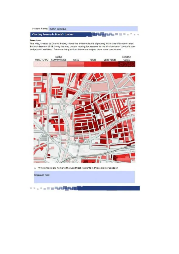
Explore Charles Booth’s 1889 map of Bethnal Green showing poverty levels. Identify wealthy streets like Kingsland Road, see how main streets host wealthier groups, and how Boundary Street marks sharp contrasts between rich and poor neighborhoods.
Loading page image...
This document has 2 pages. Sign in to access the full document!